Maps of Congo
Physical Map
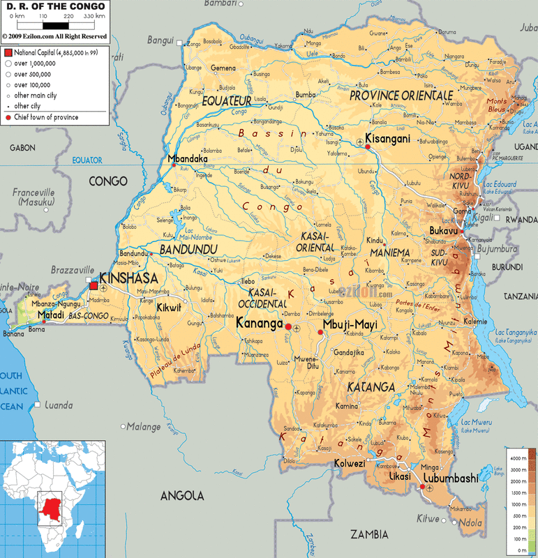
The rivers that are 4000 meters in depth seem to be diversing on the south side of Congo, which seems to empty into Lake langanyka.
Political Map
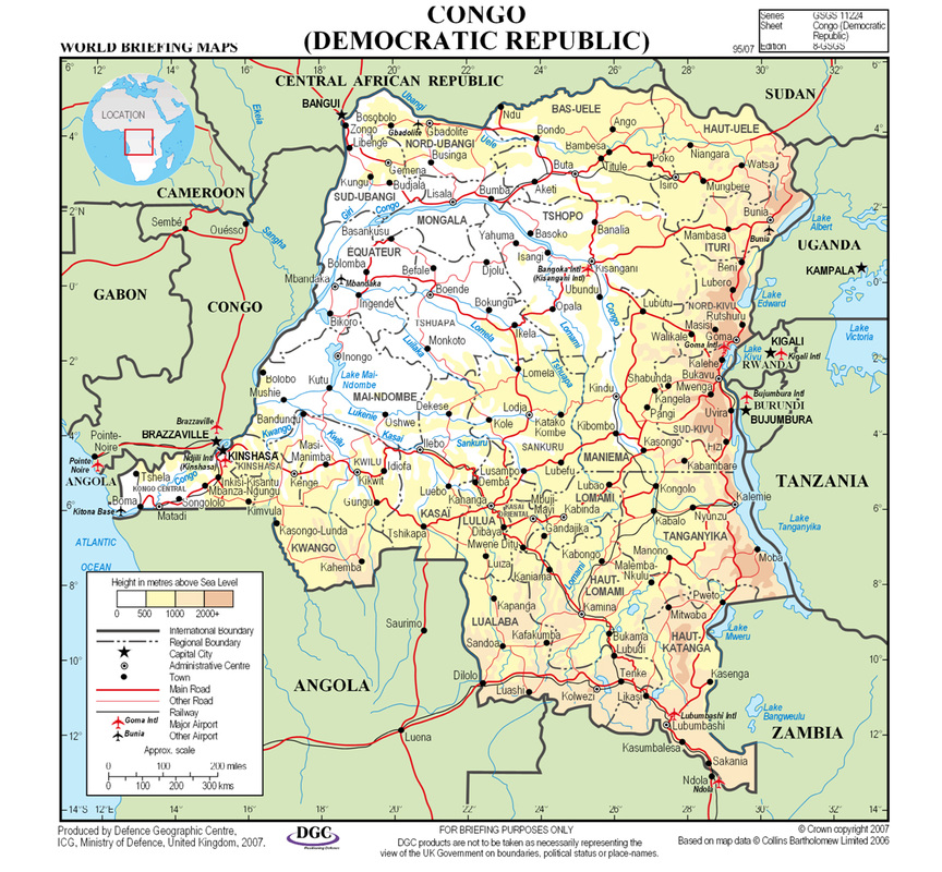
major airports- Mbandaka, Kisangani, Lumbumbashi,Mbanza Ngungu
national capitals- Brazzaville, Kinshasa, Bangui, Kigali, Bujumbura, Juba
national capitals- Brazzaville, Kinshasa, Bangui, Kigali, Bujumbura, Juba
Climate Map
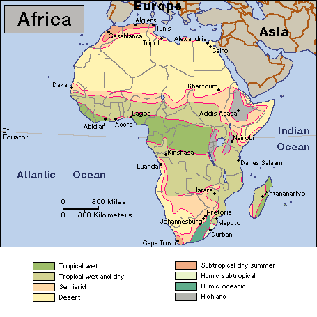
- Most of Congo lies within a humid subtropical climatic region extending five degrees north and south of the Equator.
- With congo having a lot of rainforests this makes the climate hot and humid.
- Congo is divided into three major climatic regions which are the equatorial climate zone, The tropical/subequatorial climate zone, The Atlantic climate zone
Equatorial Climate Zone
.temperatures are normally hot, the average monthly temperature rarely drops below the mid-70s F (low to mid-20s C). . .The Humidity is high, and it rains throughout the year
The Tropical/ Subequatorial climate zone
.marked by distinct dry and rainy seasons, is found north and south of the equatorial region.
.dry season lasts from four to seven months (usually April to October), depending largely on distance from the Equator.
.rainy seasons last for weeks even when drought occurs
The Atlantic Climate Zone
.Happens in the west coast of Congo.
.The low elevation and the cold Benguela Current are the major influences.
.The mountain climate occurs in the eastern high plateaus and mountains.
Population Map
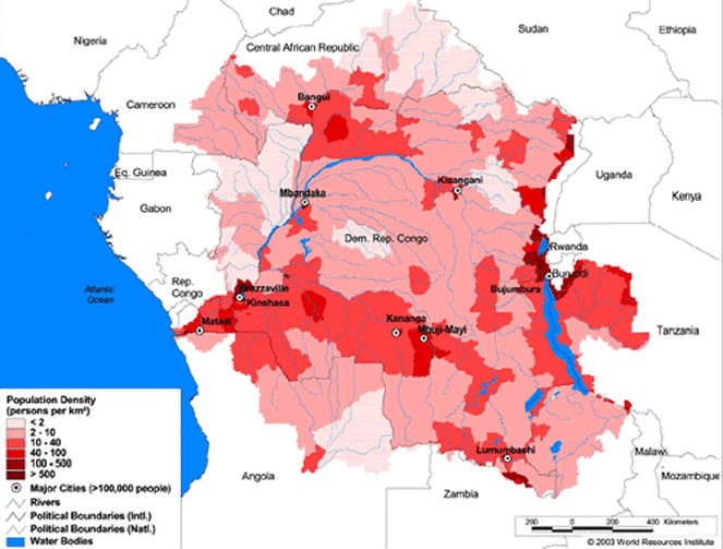
.Congo has an overall population of 67,513,677 people.
.Most of the population resides by the east,west, and south between the rivers and streams surrounding the densly and highly populated cities.
.Angola, Cameroon, Central African Republic, Chad, Democratic Republic of Congo, Equater Guinea, Ethiopia, Gabon, Kenya, Malaw, Mozambique, Nigeria, Republic of Congo, Rwanda, Sudan, Tanzania, Uganda, Zambia are the least populated areas.
Economy Map
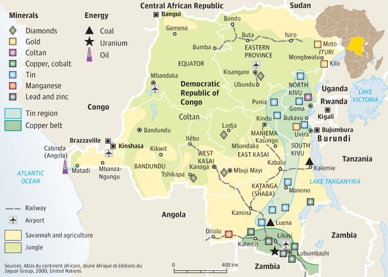
- Diamonds, Tin, Gold, Coltan
- Those minerals are found in Katanga as well as copper, cobalt, zinc, cassiterite (the chief source of metallic tin), manganese, coal, silver, cadmium, germanium (a brittle element used as a semiconductor), gold, palladium (a metallic element used as a catalyst and in alloys), uranium, and platinum.
- Those minerals are found in Katanga as well as copper, cobalt, zinc, cassiterite (the chief source of metallic tin), manganese, coal, silver, cadmium, germanium (a brittle element used as a semiconductor), gold, palladium (a metallic element used as a catalyst and in alloys), uranium, and platinum.
Historical Map
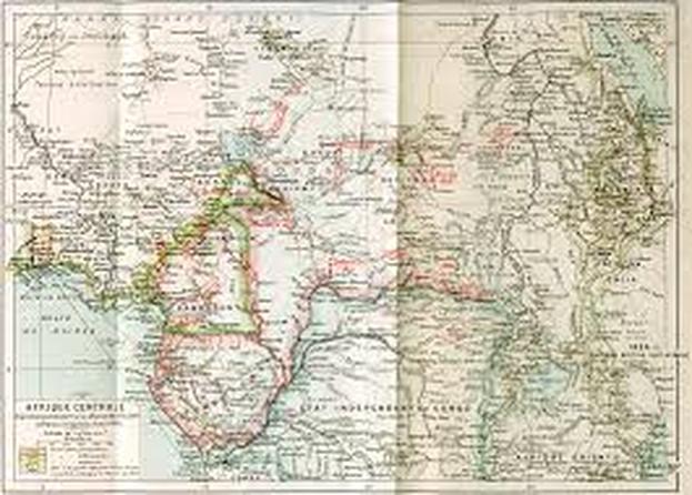
. During the 15th and 17th century several important state systems evolved in the southern savanna region.
. Those were the the Kongo kingdom in the west and the Luba-Lunda states in the east.
>Both developed elaborate political institutions with symbolic kingship and military force.
. Those were the the Kongo kingdom in the west and the Luba-Lunda states in the east.
>Both developed elaborate political institutions with symbolic kingship and military force.
